LiDAR
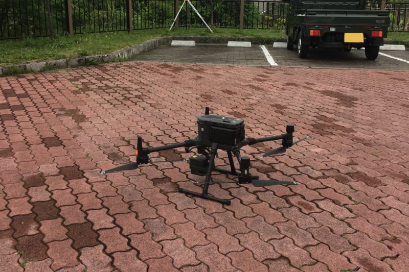
Topographic Surveying by DJI M300 and Zenmuse L1
202203/30
1
AGILE GEO DESIGN CORPORATION proposes a surveying system to easily realize high-precision surveying.
We are preparing from the VRS system package that performs high-precision surveying in real time to the high-precision post-processing baseline analysis package by post-processing.
It is a system that has been introduced in many fields such as topographic surveys, archaeological surveys, and GCP (Ground Control Point) as well as general surveying applications.
2
AGILE GEO DESIGN CORPORATION provides a surveying system to easily realize high-precision surveying. We can propose from the VRS system package that performs high-precision surveying in real time to the high-precision post-processing baseline analysis package by post-processing. It is a system that has been introduced in many fields such as topographic surveys, archaeological surveys, and GCP (Ground Control Point) as well as general surveying applications.
3
We are engaged in system development and consulting for civil construction. AGILE GEO DESIGN CORPORATION can propose a system that meets the needs of the site, from hardware to software. In addition, in collaboration with our partners, we also support the introduction, installation and support of guidance systems that support i-Construction. Furthermore, we provide cutting edge civil construction solutions using 3D design data creation and AR / VR.
4
We will hear about the current issues, from software development to hardware selection. Utilizing more than 25 years of experience in the industry, we will propose the most suitable system for “the motto of being able to use in the field”. In recent years, as new technologies have been developed, we provide system consulting that understands the situation at the site while using the latest technologies.
3
We have a lineup of the latest devices required for mapping, such as handheld computers, tablets, GNSS receivers, and laser rangefinders that are intended for outdoor use.
1
We propose high-precision GNSS and baseline analysis software that can be configured according to the application.
Even those who are trying high-precision surveying for the first time can easily get started.
This product is recommended for those who want to make precise surveys, although it is not a public survey.
2
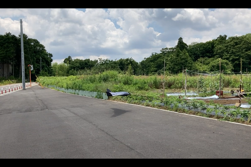
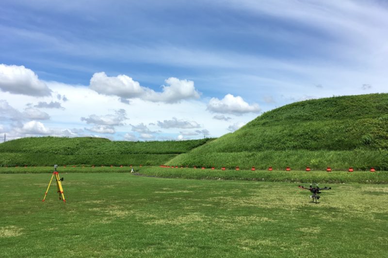
We provide a laser-mounted surveying system and a VTOL-type UAV system for aerial photography (RGB, Red Edge, near-infrared, thermal infrared).
A UAV surveying system (UAV LiDAR) equipped with a high-performance laser improves measurement efficiency and enables a wide range of ground surface data to be acquired.
This is the latest system that enables aerial photography in a narrow space with the VTOL type UAV (fixed wing + multi rotor wing), which is still rare in Japan.
4
Face recognition / Biometric identification system using network cameras and commercially available 3D cameras.
We will develop a system for the field using face recognition and biometrics as sensors.