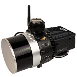
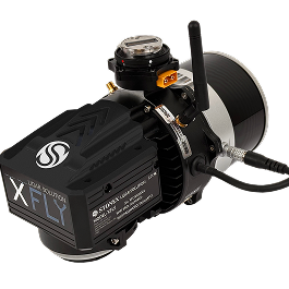
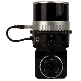
The STONEX XFLY series is a system that combines a camera and LiDAR for point cloud generation with a high-performance inertial navigation system.
You can choose a LiDAR sensor to suit your various user needs.
The processing platform includes a Wi-Fi interface, data logging software, and a gigabit Ethernet network.
It is equipped with a high-precision INS, so you can obtain clear point cloud data at any flight altitude.
Its small size, light weight and low power consumption enable long flight times, making it suitable for all types of projects.
The post-processing software generates point clouds fully automatically.
In addition, the RGB data from the 24-megapixel camera is used in the data, and the bore sight calibration values are stored in the device, so measurements can always be taken with the calibration completed.